|
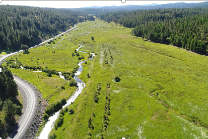
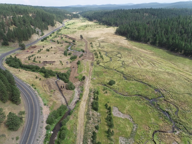
By Stefan Kelly (Confederated Tribes of the Warm Springs Reservation of Oregon) The Vinegar to Vincent restoration reach is located within the Middle Fork Forrest Conservation Area, a property owned and managed by the Confederated Tribes of the Warm Springs Reservation of Oregon. A number of anthropogenic changes have historically impacted the valley bottom through which this reach flows, and left the Middle Fork John Day in a condition mostly absent of natural riverine processes and ecological functions. In its pre-restoration condition, the MFJD’s main channel was a single thread confined against the northern edge of the valley bottom and restricted from the floodplain by a legacy railroad grade. The Tribes, the Bureau of Reclamation, and the engineering firm Interfluve worked in collaboration to develop the Vinegar to Vincent (V2V) Fish Habitat Improvement Project to restore processes and functions to this high-priority reach of critical salmonid spawning and rearing habitat. The first phase of the project, completed in 2020, included the excavation of a portion of the new main and secondary channels, as well as placement of large wood habitat structures. The second phase of the project, completed during the summer of 2022, finished excavation of the new channel network, included the placement of approximately 1,700 additional pieces of large wood, and ultimately moved the river into the new channel network. The railroad grade, which had previously served to disconnect the river from its adjacent floodplain, was removed and used to fill the old channel.
A pre-restoration (left) and during-restoration (right) comparison of the upstream portion of the V2V project reach. The mid-restoration photo shows the river relocated to its new channel and a portion of the old channel has been filled. In its post-restoration form the V2V reach is a configuration of sinuous, anastomosing channels designed to spread water throughout the valley bottom, recharge groundwater supply, provide floodplain habitat to emergent salmonids, and increase in-channel habitat for juveniles. A significant planting effort is slated to occur during the fall of 2022, and a wildlife exclusion fence will be installed to provide browse relief and allow vegetation re-establishment to occur. While the end of the 2022 implementation window marks the completion of major project elements, significant monitoring and adaptive management efforts are recognized as necessary components to ensure that this site reaches its full habitat potential. 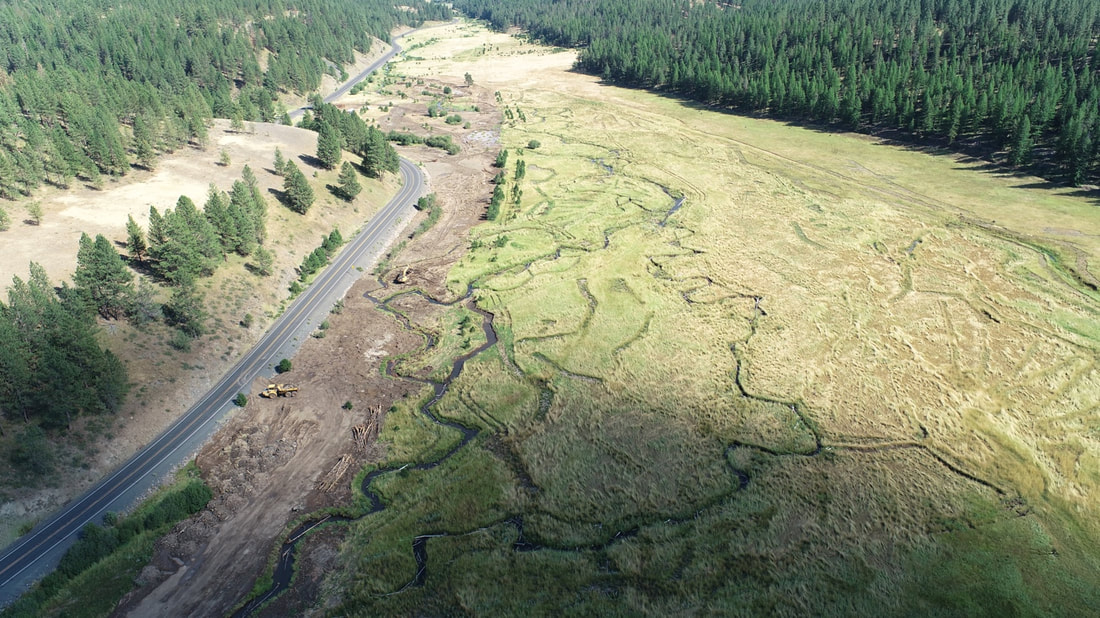 An upstream view of the newly-activated channel network. The old channel, located adjacent to the highway, has been filled.
0 Comments
|
IMW News Updates
Archives
September 2022
Categories |
 RSS Feed