|
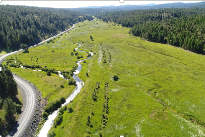
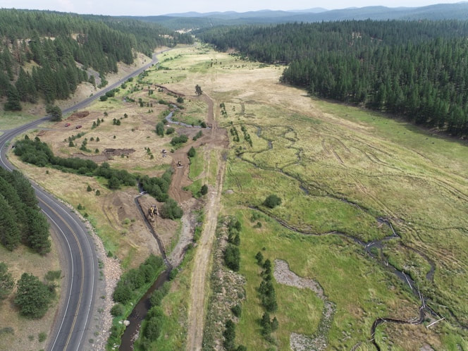
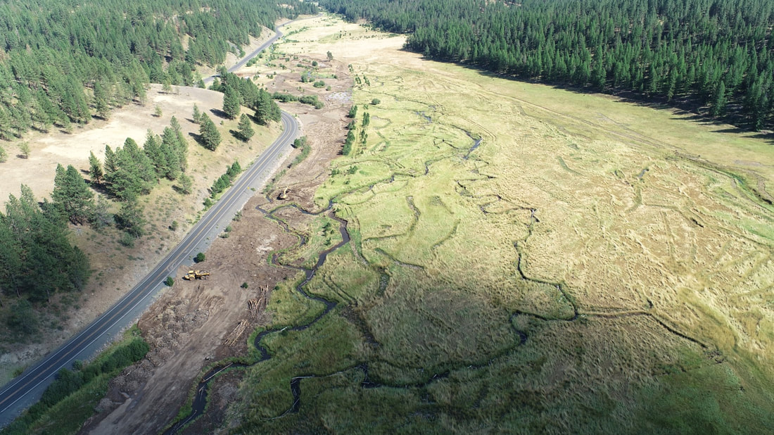
By Stefan Kelly (Confederated Tribes of the Warm Springs Reservation of Oregon) The Vinegar to Vincent restoration reach is located within the Middle Fork Forrest Conservation Area, a property owned and managed by the Confederated Tribes of the Warm Springs Reservation of Oregon. A number of anthropogenic changes have historically impacted the valley bottom through which this reach flows, and left the Middle Fork John Day in a condition mostly absent of natural riverine processes and ecological functions. In its pre-restoration condition, the MFJD’s main channel was a single thread confined against the northern edge of the valley bottom and restricted from the floodplain by a legacy railroad grade. The Tribes, the Bureau of Reclamation, and the engineering firm Interfluve worked in collaboration to develop the Vinegar to Vincent (V2V) Fish Habitat Improvement Project to restore processes and functions to this high-priority reach of critical salmonid spawning and rearing habitat. The first phase of the project, completed in 2020, included the excavation of a portion of the new main and secondary channels, as well as placement of large wood habitat structures. The second phase of the project, completed during the summer of 2022, finished excavation of the new channel network, included the placement of approximately 1,700 additional pieces of large wood, and ultimately moved the river into the new channel network. The railroad grade, which had previously served to disconnect the river from its adjacent floodplain, was removed and used to fill the old channel. A pre-restoration (left) and during-restoration (right) comparison of the upstream portion of the V2V project reach. The mid-restoration photo shows the river relocated to its new channel and a portion of the old channel has been filled. In its post-restoration form the V2V reach is a configuration of sinuous, anastomosing channels designed to spread water throughout the valley bottom, recharge groundwater supply, provide floodplain habitat to emergent salmonids, and increase in-channel habitat for juveniles. A significant planting effort is slated to occur during the fall of 2022, and a wildlife exclusion fence will be installed to provide browse relief and allow vegetation re-establishment to occur. While the end of the 2022 implementation window marks the completion of major project elements, significant monitoring and adaptive management efforts are recognized as necessary components to ensure that this site reaches its full habitat potential. An upstream view of the newly-activated channel network. The old channel, located adjacent to the highway, has been filled.
0 Comments
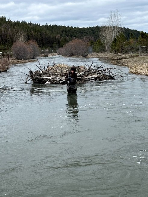
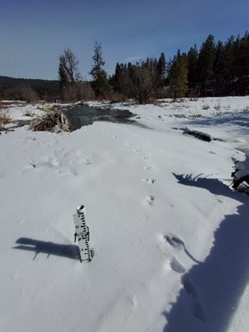
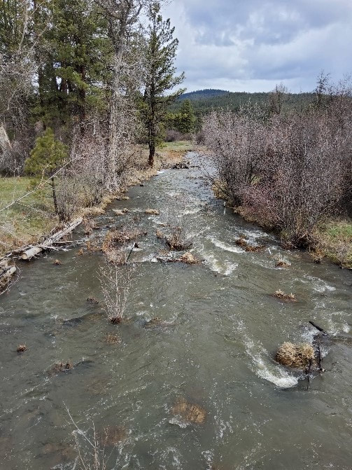
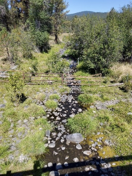
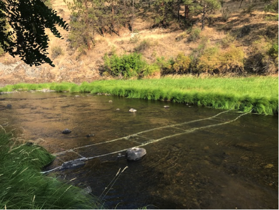
By Javan Bailey (North Fork John Day Watershed Council) Every March since 2014, staff from the North Fork John Day Watershed (NFJDWC) have braved the snow and ice in order to deploy level loggers at discharge stations. The purpose of these sites is to record hourly water levels which are translated by rating curves to stream flows. As of 2022, funding provided through OWEB and the National Oceanic and Atmospheric Administration’s Pacific Coastal Salmon Recovery Fund (PCSRF), has enabled the monitoring of 13 discharge stations in the upper MFJDR and select tributaries from March through October. While not as robust as an established USGS or OWRD gauging station, our discharge sites provide researchers and restoration practitioners with useful, localized flow information. Data from these gauges can be used to help answer questions concerning the flows at which floodplains are inundated, the timing and duration of peak and base flows, and how restoration may impact these conditions. Changes in the timing and/or magnitude of flows potentially have consequential ecological impacts on biological conditions such as the timing of emergence and availability of water during summer flows. Photo Credit: Javan Bailey (NFJDWC) Manual flow measurement on the MFJDR below Vincent Creek using a Hach FH 950 flowmeter. A raccoon visited our discharge station at Camp Creek prior to level logger deployment. High flows in Camp Creek – April 2022 Low flows in Camp Creek during the summer of 2021.
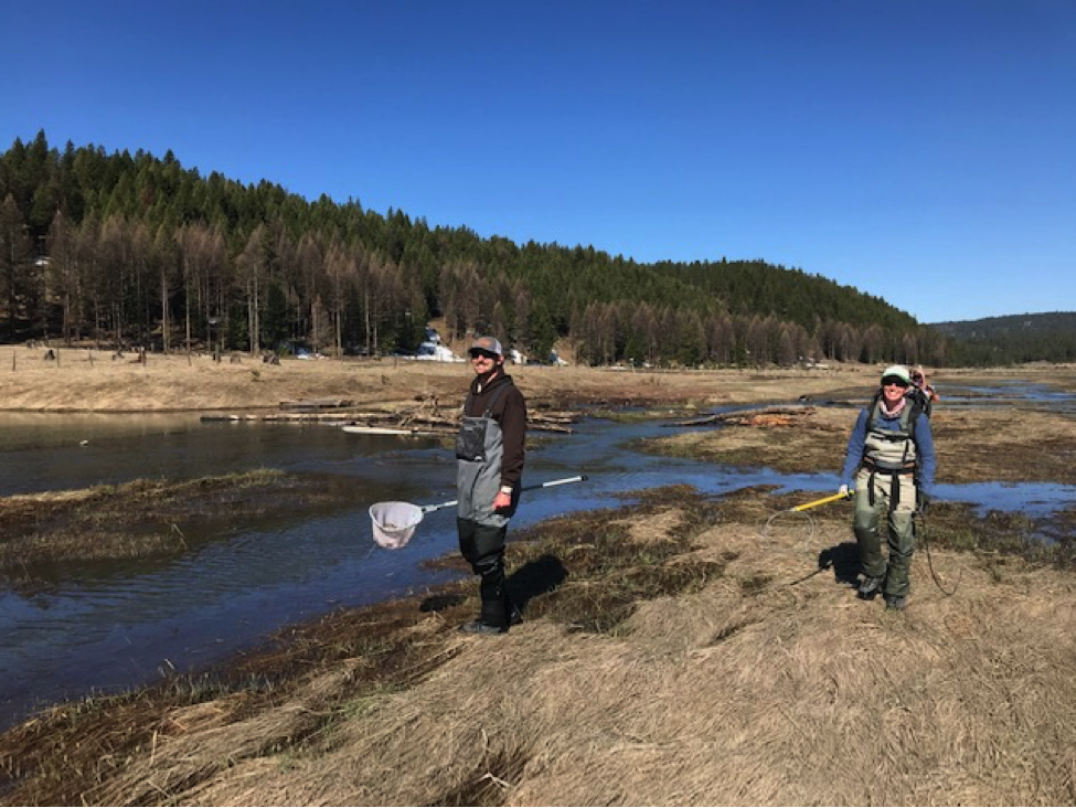
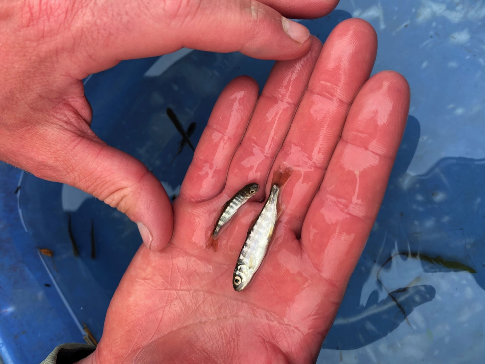
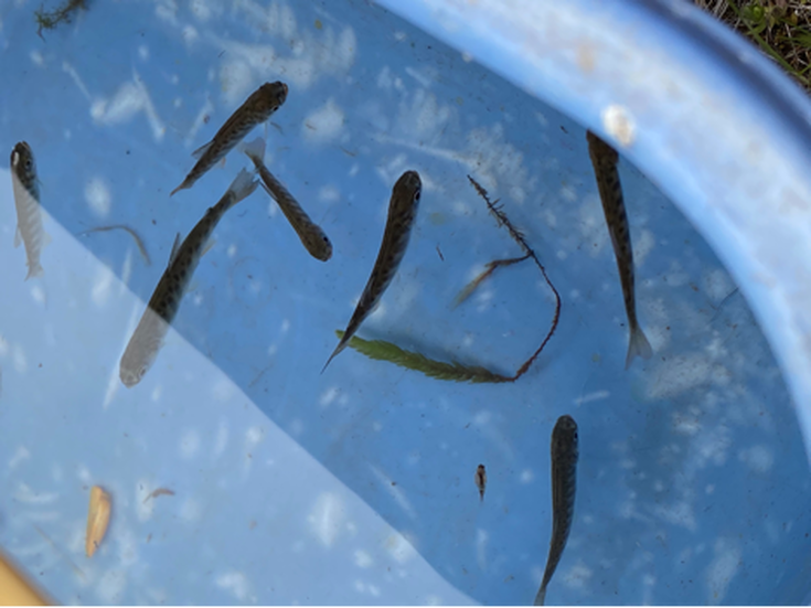
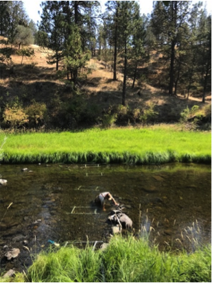
by Matthew Kaylor (CRTFC) and Evan Booher (ODFW) MFIMW partners including Oregon State University (OSU), Oregon Department of Fish and Wildlife (ODFW), the Columbia River Inter-Tribal Fish Commission (CRITFC), and the Confederated Tribes of Warm Springs (CTWS) are investigating when Chinook Salmon fry leave spawning gravels (emergence) across the Middle Fork John Day River (MFJD). This is important to evaluate because emergence timing determines the conditions fish first experience (temperature, food availability, flow, habitat accessibility) and the amount of time fish have to grow. Differences in emergence timing across the watershed may translate to differing experiences in growth and survival as well as differences in their ability to access floodplain habitat. Staff from the Oregon Department of Fish and Wildlife sampling for Chinook Salmon fry in inundated floodplain areas of the Middle Fork John Day River. Researchers first modeled emergence timing throughout the MFJD using data on the timing of spawning and water temperature. They found that emergence was earliest upstream near Bates State Park and was progressively later downstream. This is the opposite pattern of what they found for other NE Oregon rivers in the Grande Ronde River basin, and may be attributed to upstream groundwater inputs which are warmer in winter compared to colder surface water. To evaluate these predictions, ODFW and CTWS began capturing fry at multiple locations along an upstream to downstream gradient throughout the MFJD during spring 2021. They sampled fry at these locations every week from March through May and will examine the size of fish over time to determine when peak emergence occurred, which will then be compared to modeled predictions. Lastly, in collaboration with the National Oceanic and Atmospheric Administration (NOAA), researchers are modeling when and where floodplains are flooded across the MFJD using historical flow records and satellite imagery. Floodplains provide important habitat to juvenile salmon by providing abundant prey and refuge during high flows. The researchers are determining when fish emerge relative to when floodplains are flooded to determine how fish may use these habitats, and where floodplain restoration may be most impactful for juvenile Chinook Salmon. Juvenile Chinook Salmon captured in the Middle Fork John Day River in spring 2021 to evaluate emergence timing from nests. The fish on the left was a newly emergent fry, while the larger fish on the right was transitioning to the parr life stage. Chinook Salmon fry captured in the Middle Fork John Day River to evaluate emergence timing from nests.
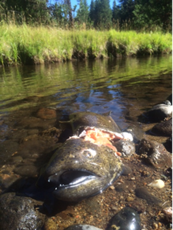
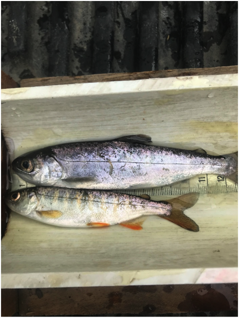
Inundated floodplain in a restoration area of the Middle Fork John Day River during early spring runoff in 2021. Floodplains are important habitat during the early life stage of juvenile salmon, providing refuge during high flows, abundant prey, and thermal conditions conducive for fish growth. by Matthew Kaylor (CRTFC) and Evan Booher (ODFW) Once the warm temperatures and low flow conditions of summer arrive, juvenile Chinook Salmon hunker down and move little until flows increase in the fall. However, we know little about movement in spring because fish are too small to mark with PIT tags and challenging to capture as high flows make sampling inefficient. It is important to determine patterns of fish movement during this early-life period because it sets the stage for where juveniles spend the critical summer period. This information can provide guidance for prioritizing and locating restoration projects to maximize juvenile salmon use. Using genetics as a tracer, MFIMW partners including Oregon State University (OSU), Oregon Department of Fish and Wildlife (ODFW), the Columbia River Inter-Tribal Fish Commission (CRITFC), and the Confederated Tribes of Warm Springs (CTWS) are quantifying movement from redds (salmon nests) to summer rearing habitats in the Middle Fork John Day River (MFJD). In September of 2020, genetic samples were obtained from 111 adult salmon after they spawned, which represented roughly a third of the spawning population. In addition, the location of each fish was recorded. During the summer 2021, the offspring of these adults will be captured from locations throughout the MFJD and fin clips will be collected for genetic analysis. Sampled juveniles can then be matched to previously sampled parents through genetic parentage analysis, which then provides a location of where juveniles originated. The project will occur over an additional year (adults from 2021; juveniles from 2022), with a greater focus on sampling Chinook fry from floodplain habitats to determine dispersal patterns shortly after they emerge from redds. The Chinook Salmon life cycle comes full circle in streams and rivers of the Columbia River basin. The locations at which adult Chinook Salmon spawn and ultimately perish (left) could play an important role in determining habitat use of the next generation of juvenile Chinook Salmon (right).
By Evan Booher In August, 2020 ODFW staff installed a new type of fish detection antenna at a site on the Middle Fork John Day River (MFJDR) near Ritter, OR. These new antennas, designed by ODFW employees, are made of loops of low-power electrical wire encased in PEX plumbing tubing. Their low profile will enhance their durability during flood and ice events that often damage previous designs. The antennas detect fish that were tagged with passive integrated transponder (PIT), radio frequency tags when they were either juveniles in the river or as adults at Columbia River Dams. This detection site will provide valuable information for counting and estimating survival of salmon and steelhead benefitting from the restoration work being implemented in the John Day River. This site is also part of the Middle Fork John Day River, Intensively Monitored Watershed (IMW) and complements other data being collected to monitor salmon and steelhead. Multiple interrogation sites will allow managers to estimate the return of adult chinook and steelhead prior to spawning and estimates derived from these monitoring efforts provide real information for tracking the recovery of these populations. Patterns in the movement and survival of threatened salmon and steelhead stocks are essential information for their management in Oregon watersheds. PIT tags are widely used throughout the Columbia River basin to assess these population characteristics by multiple fishery agencies and these data are stored in a centralized database: the PIT Tag Information system (PTAGIS). Detections of PIT-tagged fish at Columbia River dams and throughout the Pacific Northwest, are used to monitor migrating salmon at multiple stages of their life cycle. This data is used as a standard for adult performance in NOAA’s Biological Opinion for the recovery of federally-listed salmon and steelhead in the Columbia and Snake River basins.
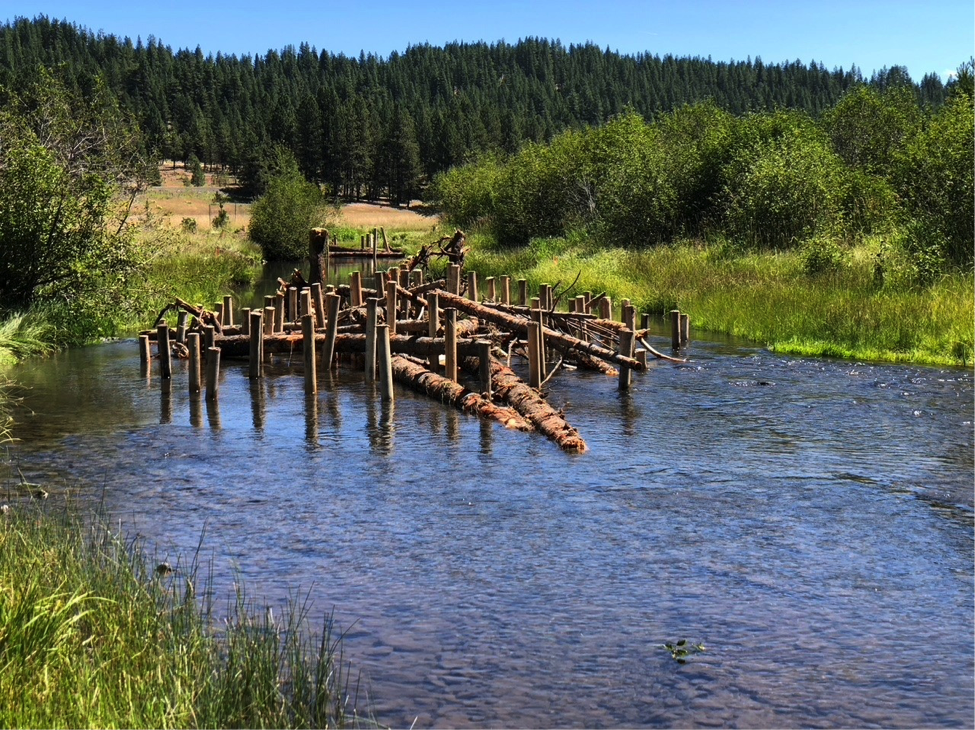
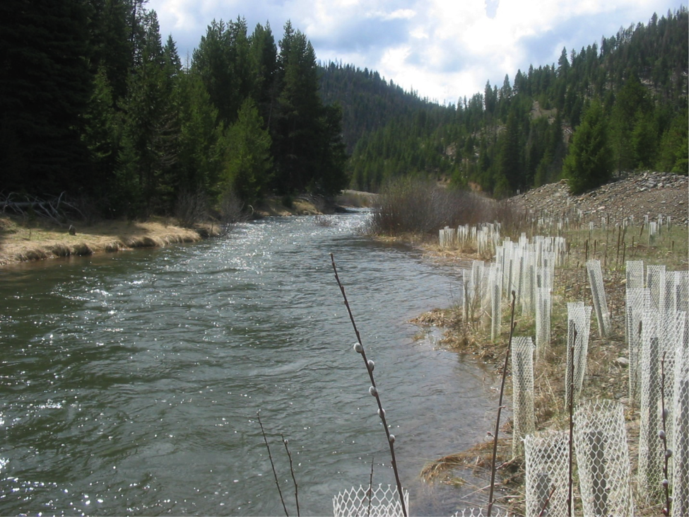
By Kasey Bliesner MFIMW partners recently completed Phase II of the Vincent to Caribou habitatdisrupted natural channel migration patterns, were removed. To improve and increase more natural instream fish habitat, some of the The project installed or placed 700 cubic yards of gravel, and added roughly 600 trees across 80+ structures. 20 pilot channels were also excavated to better allow the river to access the flood plain during high flow events. For this project, CTWS employed innovative, low cost, low impact methods to place and anchor these large wood structures, replacing the more invasive practice of burying portions of the wood in streams banks for anchoring. Burying portions of the wood in stream banks isn’t natural, is slow and expensive, creates a lot of turbidity, and exposes disturbed ground to weeds and erosion. With the Phase II methods, most wood is simply placed on the ground without excavation (as natural tree-falls would occur), and wood structures are stabilized with posts. These posts are intended to stabilize wood structures in the short-term, while allowing for more natural large-wood movement and function processes in the long-term. This project also consists of several riparian enhancement elements. Several studies performed throughout the MFIMW over the last 12 years have identified elevated summer stream temperature as the largest factor limiting productivity of salmonids in the Middle Fork John Day River, and that this factor is mostly facilitated through solar exposure due to lack of shade relief from riparian vegetation (See Shading Out Climate Change: Planting Streamside Forests to Keep Salmon Cool). In effort to improve riparian condition and function, CTWS will be installing three riparian vegetation enclosures to protect over 55 acres of riparian area, as well as planting approximately 3,000 sedges and over 4,000 woody species such as Cottonwood, Alder and Willow in 2020. The lead for this project is the Confederated Tribes of Warm Springs and partners include the Bureau of Reclamation, Bonneville Power Administration, Pacific Coastal Salmon Recovery Fund (NOAA), and Oregon Watershed Enhancement Board. By Kasey Bliesner High stream temperatures in the Middle Fork John Day continue to be a limiting factor for salmon and steelhead. Research into keys factors for reducing stream temperature in the Middle Fork John Day IMW area led by Steve Wondzell (research ecologist, USFS PNW Research Station) was recently highlighted in the June 2020 edition of the USFS PNW Research Station publication PNW Science Findings. Wondzell and his team used water temperature modeling to study and predict how stream temperatures could change in response to future changes in air temperature, stream discharge, and the amount of shade provided by riparian vegetation. Modeling results showed “the effect of restoring riparian forests on streams where shade is currently lacking could be so large that future stream temperatures could be colder than today, even under a warmer climate with substantially lower late summer streamflow.”
Follow this link to read more… By Kasey Bliesner The Middle Fork John Day IMW workgroup summarized 10 years of restoration and scientific monitoring in a fact sheet for restoration practitioners in the Mid-Columbia River Basin. In the initial 10-year period (2008-2017) of the MFIMW, over 100 active and passive restoration projects of varying size and scope were implemented. 20 organizations participated in monitoring activities resulting in over 14 scientific reports. A comprehensive Final Summary Report synthesized results and represents 10 years of work by agencies, organizations and individuals conducting restoration, research, and monitoring activities. In order to quickly share results of the report with restoration practitioners, the MFIMW workgroup recently produced a fact sheet distilling findings. It features the MFIMIW’s goals, key findings and lessons learned from 10 years of paired restoration and monitoring. The fact sheet is available in two formats:
By Emily Davis
After ten years of hard work, the Middle Fork IMW Working Group is celebrating the completion of its Final Summary Report. The Final Summary Report summarizes data collected from 2008 to 2016. This report represents 10 years of work by numerous agencies, organizations and individuals conducting restoration, research, and monitoring activities in the upper Middle Fork John Day River. Each principal investigator and their co-authors wrote a final report, which represents the culmination of their research and monitoring. The reports were compiled, along with pertinent background information, into this final Summary Report. An extensive overview of MFIMW activities, key findings, and recommendations can be found in the Executive Summary. For full details about a specific monitoring project including methods, analyses and results, readers can refer to Appendices B-M, which are compiled in a separate document. Links, bookmarks, and navigation have been provided, where possible, to ease in viewing this document electronically. Final Summary Report Access the Appendices More is in store for the Middle Fork IMW in 2018. Be sure to check back for additional news items, and meanwhile, enjoy perusing the Summary Report!
By Emily Davis
The summer of 2016 was a chaotic one at Oxbow Conservation Area. Excavators, fencing crews, scientists, and Tribal staff all hurried to finish the last phase of the five-year Oxbow Mine Tailings Restoration Project before season’s end. Amid the hustle and bustle, you might have observed something a little different: two women with microphones and film cameras, dodging in and out of the hubbub to get the best shot, or herding someone away from the racket for a quiet interview in a meadow. The two filmmakers were Michelle Alvarado and Jen Rule, who make up two-thirds of the talented Bend-based company Wahoo Films. Their short film Náimuni: Connecting Oxbow Conservation Area celebrates the completion of one of the biggest river restoration projects ever to take place in the State of Oregon. Along the way, the film explores the history of the upper Middle Fork John Day River, and its journey from damaged dredge-mined ditch to thriving salmon stream via the lengthy restoration process. The theme of connection is woven throughout— as heavy equipment works to reconnect the river to its floodplain, we see how improving salmon habitat will also benefit the myriad other interconnected pieces in the ecosystem. ‘Náimuni’ means ‘connecting’ in Ichishkíin, one of the languages of the Confederated Tribes of Warm Springs, who own the conservation area and led the restoration effort. Enjoy—and for more information on the project or to see past films exploring different aspects of this restoration effort, be sure to visit our video gallery, read more in-depth articles, visit the Warm Springs’ Fisheries web site, or come visit the Oxbow yourself! |
IMW News Updates
Archives
September 2022
Categories |

 RSS Feed
