|
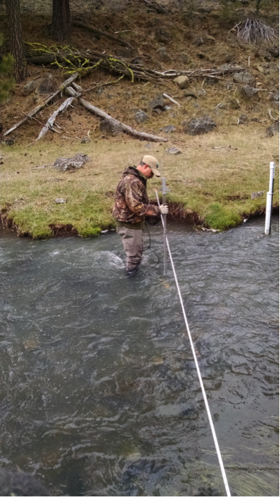
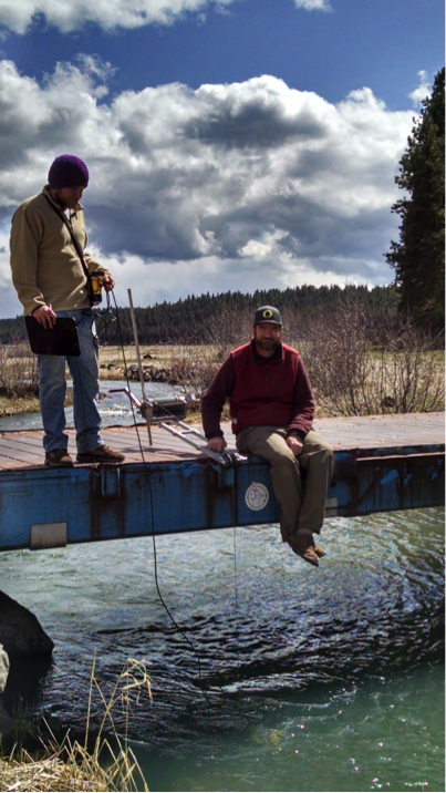
By Emily Davis If you live on or near the Middle Fork John Day River (Middle Fork), you know that the amount of water in the river fluctuates widely throughout the year—from the roar of spring runoff to the quieter trickle of late summer. But did you know that measuring river flow is an important piece in the puzzle of salmon restoration? High flow measurements are key to understanding how restoration actions in the Middle Fork are affecting fish habitat, so being able to keep track of flow is important. The North Fork John Day Watershed Council (NFJDWC) routinely takes river and stream flow measurements in the Middle Fork. NFJDWC staff usually take these flows during times of the year when it’s easy to wade in the river, such as the low-flow season of early fall. Because of the dangers of trying to wade the river when the water is high, the NFJDWC crew was unable to collect data during these times in the past. But why bother with taking flow measurements during high water, if we already have measurements during low water? Without these measurements year-round, we’re only seeing part of the picture of what river scientists call the ‘hydrograph’, the story of what a river does over the course of a year. It’s like putting together a quarter of a jigsaw puzzle and trying to infer what you might see on the rest of the puzzle, based on the corner you have in front of you. Now, for the first time, the NFJDWC is able to get flow measurements during dangerous high-water events, and start putting together the rest of the puzzle. Using specialized equipment, and working with partners from the Bureau of Reclamation and the Malheur National Forest, NFJDWC staff successfully measured stream discharge this winter at flows that would have almost certainly knocked someone trying to use the traditional method right off their feet. The traditional method is simple: a researcher wades across the channel with a current velocity and depth meter, taking measurements every few feet. In the Middle Fork, at twenty cfs (cubic feet per second), the river slides lazily by and the water comes up to a researcher’s ankles; at seventy cfs, it becomes difficult to stay on your feet; and at several hundred cfs even the hardiest hydrologist would avoid stepping foot in the channel. The new method follows the same principles. It takes a little more time, but is much safer at high water. Flows are measured with a sounding reel from a bridge near the usual flow measurement site. A sounding reel is a specialized cable on a winch with a crank. Weights are put on the end of the cable to keep it steady in the current; the cable can then be lowered into the water to measure depth. A current velocity meter can also be attached to the cable and used to measure velocity from the safety of the bridge. The additional high flow measurements create a more complete picture of year-round flow in the Middle Fork. By understanding the changes the river undergoes during all seasons, we can get one step closer to understanding how to improve watershed health and support thriving fish populations.
North Fork John Day Watershed Council, Bureau of Reclamation, and Malheur National Forest staff
using a sounding reel to measure high flows in the Middle Fork John Day River
0 Comments
Leave a Reply. |
IMW News Updates
Archives
September 2022
Categories |
 RSS Feed